
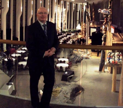
This month, InsideNC catches up with Darren Platakis, graduate of NC’s Geographic Information Systems/Geospatial Management Post Graduate Certificate program (2011).
The St. Catharines resident has been working as planning and data/GIS administrator at the Regional Municipality of Niagara since he graduated from NC in June 2011. He also founded a group called Geospatial Niagara which promotes geo-literacy and community participation through geography.
Platakis came to NC after obtaining his Honours BSc. In Geography from Brock University in 2010.
Here is what he had to say:
Why were you attracted to this field of study?
I have always been interested in geography from a very young age. I still remember painting maps in Kindergarten. After high school I applied to and was accepted at Brock University for Geography but life got in the way for 16 years.
I started tossing around the idea of going back to school in the spring of 2004 and was looking for something interesting and found the GIS/GSM Post Graduate program and attended the thesis presentations, which is where I met Ian Smith. I was unaware at that time that I needed to have a degree or relevant experience to attend. I wanted to attend Niagara College right away but I needed to go to Brock first.
A co-worker of mine and I had a conversation one day at the restaurant we worked at about what we would do differently in life and we both agreed it was to go to/finish school. It was a classic “If you do it, I’ll do it”. So I registered for Brock in Geography and she registered for Niagara College for Accounting. She worked and went to school full time for two years and I started at Brock part-time and then switched to full time. I was at Brock for 5.5 years and I knew the whole time I was going to go to Niagara afterwards.
Why did you choose NC?
I would be lying if I said location wasn’t a factor because it was. I mean, it’s right in our backyard. Aside from that, the GIS/GSM program has an incredible reputation for student preparation into the working world and a very high placement rate. A lot of people that I know who have gone through it came out with a job waiting for them or were hired within 6 months of finishing. Sometimes, the thesis projects turn into full time positions.
Another reason was that I told Ian that I’d be back and I kept my word.
What did you enjoy most about the program?
What I enjoyed most was the real world, hands on experience. That came from the steps taken in fulfilling the thesis project but it was also part of the day to day curriculum. Professionalism in communications with the faculty was also a great way to prepare for the consulting world and for sending out resumes etc.
Having to create your own GIS consulting company was great too. I still have mine; I just turned it into a real entity after graduation.
Given the demands of the program, most of my time was spent in the classroom, sometimes 12-15 hours a day along with a lot of other people. That was spent on projects, assignments or job searching. We were a tightly bonded group.
The GIS/GSM program was instrumental in preparing for a career. I’m not sure I would have known what to expect coming out of university into the work force. Ian even taught the guys how to do a double Windsor knot for tying a tie.
How did you find the transition between graduating and find a job?
The transition was very quick. I actually had the position before I finished the program but I wasn’t going to start until the program was done. I had a weekend off between finishing Niagara College and starting my job.
The position that I applied for was posted on the Niagara College career page. It was for an internship contract that was supposed to finish in September 2011. That got extended until the end of 2011 and my immediate supervisor at the time retired. I applied for his position and started full-time in January 2012.
Describe your responsibilities at the Niagara Region:
Day to day data entry, georeferencing of development applications (subdivisions, condo, zoning etc) and maintenance of the iDarts (Integrated Development Application Retrieval and Tracking System) in the Development Services Division of Public Works. Working with planners and managers to create the maps they need for reports. Monthly, quarterly reporting of volumes of development applications received.
In addition to your current position, name jobs you’ve had since graduation
Concurrent Positions: Brock University Geography Department Teaching Assistant (four years), Vineyard Management Technician (four and a half years), 5DB Geospatial Consulting and Research (three-and-a-half years), and Geospatial Niagara (1 year)
What led to the formation of Geospatial Niagara?
Officially, Geospatial Niagara launched in January 2013. I had the initial thought for Geospatial Niagara in August of 2012. That grew out of the realization that outside of municipal government, Brock University and Niagara College, there were no GIS consultants in Niagara. If you Googled GIS and Niagara all the results were Brock/Niagara and Niagara Region. This led me to believe that we in Niagara (or Niagara businesses) are underserved. Sure there a pockets of GIS people siloed in other business but for the most part they are only doing work that pertains to their business (Aecom, Hatch etc.)
The second part came about in from a desire to give students a reason to stay in Niagara. It’s no secret that the economy of Niagara is changing and we need to capitalize on the education assets we have (Brock/Niagara). Since GIS/Geography operates across most (if not all sectors) we should be educating our youth to create the critical mass of talent that geospatial companies look for suited to what Niagara has to offer. Why should our youth need to leave when the companies can come here? Better still; provide the opportunities for youth to create their own start-ups.
The third part came about from CBC report of a Dalhousie University Sociology professor who gave her students a quick Geography Quiz every year and consistently they would mislabel the location of the Atlantic Ocean or Europe. Somewhere the education system has failed to teach geo-literacy or spatial skills. I began to think about how, despite living in Niagara region, how many students could name all of Niagara’s 12 municipalities? Probably not many. Students are taught the Rocky Mountains, or the Canadian Shield but we don’t even teach them about their own backyard.
Teach a student about their municipality, their geography and about the others that make up Niagara and soon you will have students that are more engaged in their own and the broader community. These are students that will be more apt to volunteer for events such as stream or shoreline cleanups etc. They become invested in their community and become a citizen of Niagara, not just of St. Catharines or Niagara Falls etc. As they get older I believe that these young adults (if they leave for school) will tend to come back because they have invested in their community. They may even be more apt to vote in municipal elections or take part in public meetings and want to affect change in their community.
What is the mission or mandate of Geospatial Niagara?
Through educational and community engagement initiatives, Geospatial Niagara is the only organization that leverages local talent, resources and expertise in order to increase geospatial literacy towards the development of a geospatial cluster in Niagara.
Who is involved in this group?
The core of the group consists of me, Justin Serroul and Brendan Spearin, both past GIS/GSM graduates and current GIS student Ashley Northcotte.
Others involved include some professors from Niagara College and Brock University, the executive directors of the Niagara Workforce Planning Board and Niagara Connects.
What do you do through Geospatial Niagara?
We have a number of initiatives on the go. We’ve facilitated three projects that are current thesis projects in the GIS program as well as sponsored one – Vineyard Site Suitability in Elgin County. We are trying to shine the spotlight on this program by assisting the procurement of projects.
We have created three projects: TreeOcode Niagara, The Carlin Report and Eventally.
TreeOcode Niagara is volunteer-led initiative that uses a crowd-sourcing approach to building and sustaining a comprehensive tree inventory across the entire Niagara region using smart phone apps feeding an open spatial database.
The Carlin Report combines citizen participatory engagement and volunteered geographic information to crowd source near hits between walkers, runners, cyclists and motorized vehicles. Data collected can be utilized by a number of stakeholders to mitigate incidents and shed light on problem locations within a municipal area or region. This project is collaboration between Geospatial Niagara and Software Niagara.
Eventally is a platform which will allow organizations to collect data as it pertains to event
attendance. It is a combination of data collection and educational outreach. This project is a collaboration between Geospatial Niagara and Software Niagara.
We also are involved in educational outreach, visiting schools to promote geography and geo-literacy – from Kindergarten to Grade 12. We did our first classroom visit on Wednesday, November 20 (GIS Day) to a couple of Grade 5 classes and it went extremely well. I was so happy to be able to promote Geography and teach the kids about Niagara.
We are hoping to be able to provide a means for those students interested in geography and geospatial technologies a place where they can perform their volunteer hours towards a community based project under the mentorship of a member of Geospatial Niagara. Giving the students some valuable real world experience. We’d also like to attend local events to promote geography and geo-literacy.
Another goal of Geospatial Niagara is to create the Geospatial Niagara Conference and Career Fair to showcase the geospatial work and research being undertaken in Niagara as well as showcase the work of organizations and companies in Niagara. This will help to show students that there are opportunities in Niagara for rewarding jobs. Niagara can be a hub of geospatial activity.
What are your other involvements?
I was nominated to become a member of the College of Fellows to the Royal Canadian Geographical Society in September of 2013. I’m truly honoured to have been nominated and to be a part of this organization. My hope is that it provides me the ability to do more for Niagara in terms of shining the spotlight on the talent we have here. The only College of Fellow members from Niagara are me and Adam Shoalts both of us nominated this year so it is quite an honour and also humbling.
I’m also involved in Niagara GoGeomatics Group, which came about from a group of classmates at Niagara College. We had a class that ran really late and when it was over we’d go out for some wings and drinks. The GoGeomatics Canada website was a job search site based in Ottawa and I noticed that they were having networking events once a month. I contacted them and asked about starting a group in Niagara, and that started in November 2011.
The group is really all about networking, connecting students and those interested in GIS/Geography etc with professionals. It’s also a way for us to also collaborate and help each other out if we have technical challenges. We usually meet on the last Saturday of each month in the evening.
GoGeomatics Canada has gone from being solely a job search site to include an online magazine and I have contributed some posting. They encourage people to contribute to the magazine portion. If you have a passion for GIS/Geospatial and like to write they will accept submissions. It’s a great way to contribute to the profession.
I’m also a participant in the Walk for Kids Help Phone as well as the Rankin Cancer Run in May. I usually volunteer at the Brock University Fall and Spring Open houses as a representative of the Geography Department.
When not involved in groups what are you doing?
When I’m not at one meeting or another or at work, as a single dad, I am spending time with my boys or at the YMCA gym.
What am I most proud of?
There are a number of events that I’m proud of– certainly being nominate to the College of Fellows would be one of them, but during Geography Awareness week (Nov 17-23, 2013), on GIS Day (Nov. 20th), myself and a colleague from Geospatial Niagara went to a local public school and presented a lesson on the municipalities of Niagara to two Grade 5 classes. I absolutely loved it!
So far I’m most proud that I was able to impart some knowledge, enthusiasm and passion about Geography to those two classes. If only one of those students goes on to become a Geographer or sees me 10-15 years from now and recalls my visit, then I have succeeded. Students today need to be geo-literate and I want to play a role in that.
What advice do you have for current students?
Network, network, network. A former professor once told me, “Take what you can get until you get what you want”. I think it’s a given that the days of working for one company from the time you graduate until you retire are long gone. Be prepared to have a number of jobs all within the sphere of your career. It’s almost like playing in the NHL and playing for several teams throughout your career.
If you cannot find a job, volunteer to utilize your skills.
Do you know a successful graduate of Niagara College that you would like to see featured? Email [email protected]
