
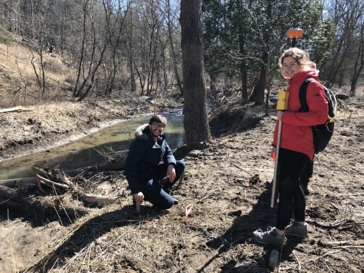
Jaimie Snelgrove and Pedro Gurgel navigate a small section of Twelve Mile Creek, contained within Shorthills Provincial Park in Pelham, installing small thermal markers along the creek. While it may not seem it, the two are helping one of the country’s foremost conservation agencies protect the survival of Brook Trout – Niagara’s only native species of trout, and one in danger of extinction in the region.
Snelgrove and Gurgel are students in Niagara College’s Geographic Information Systems (GIS) – Geospatial Management Graduate Certificate program, and recently completed the final thesis project that is the hallmark of the program. The project allows students to work throughout their ten months in the program on a real-world problem posed by governments, businesses and community organizations. Their findings, delivered during a special presentation at the end of the program on June 14, provide tangible information those organizations can use to help their businesses grow, or make meaningful contributions to the community and environment.
The projects bring a substantial economic benefit too. Over the 22 years the program has been running, program coordinator Ian Smith estimates that student projects have contributed between $10 and $15 million worth of geospatial analytical work to companies and organizations in Niagara and across Ontario.
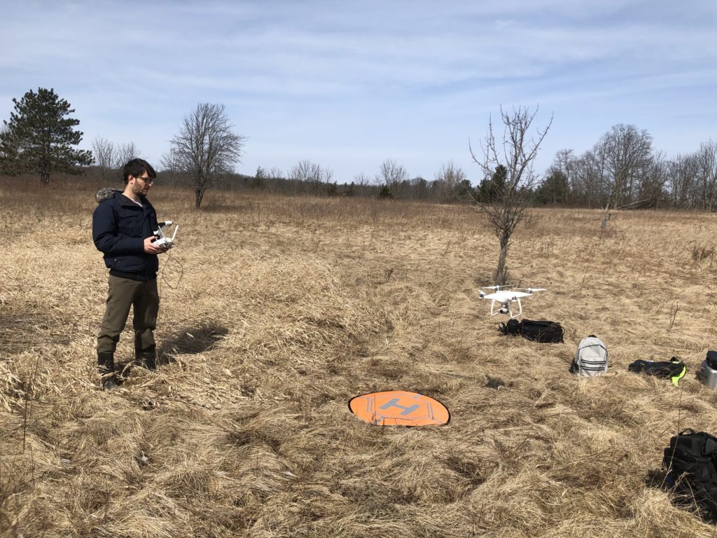
In Snelgrove and Gurgel’s case, their work helped provide Trout Unlimited Canada with invaluable data that will help the organization ensure Twelve Mile Creek remains a suitable habitat for the Brook Trout that call it home. In addition to on-the-ground work, the pair made extensive use of drones to create detailed geomorphological maps that tracked changes in the stream from month-to-month and year-to-year. Examining how the stream changes over time can help Trout Unlimited identify new locations along the stream that might help the trout thrive. They’ll also print a 3D model of a portion of the creek to help visualize the project.
For Gurgel, an international student who trained as an engineer in Brazil prior to coming to NC, and Snelgrove, from nearby Jordan village, and who completed an undergraduate degree in geography at George Washington University, the hands-on field work and in-classroom training, all of which culminated in real ecological restoration work, was an invaluable experience. “The thesis project is a highlight of the program,” said Snelgrove. “You make your own data and analyse it. There’s extensive field work and a real client application, so it’s more realistic than other school projects.”
Darren Platakis, a 2011 graduate from the program, is founder and executive director of Geospatial Niagara, an organization that seeks to promote geo-literacy and community participation in Niagara through geography. The organization was behind a recent project through which NC GIS program students created a 1:1 scale Minecraft map of the topography, road network and hydrology of the Niagara region.
Platakis has seen the significant, and often unrecognized, impact that geography and GIS technology has in their community. “People often don’t know about the municipality that makes up their own backyard,” said Platakis. “And that often leads to them being disengaged from their community.” Other projects Geospatial Niagara has coordinated include analysing the typographies of Niagara and other Ontario communities to find suitable sites for vineyards and hop yards.
Platakis would also like to foster better awareness of the importance of geography in young people, and is a strong proponent of GIS Day in November. “There’s a real need for geographers across many different sectors. The goal of Geospatial Niagara is really to promote the sector here in Niagara, and a big part of that have been the College’s thesis projects.”
Program coordinator Ian Smith also emphasized the fact that geospatial data influences many aspects of our daily life, often without us knowing. “Big data and analytics are becoming more and more important,” he says. “Companies are tailoring their marketing strategies by merging geographical data with sales numbers, for instance. Governments are using these data to determine where social services should be focused. There are just so many applications of these data and geospatial technologies.”
Students are exposed to the potential of this data through courses in statistics, but also receive value-added training throughout the program. Gurgel and Snelgrove, for instance, are in the midst of becoming licensed commercial drone operators, normally an eight-month process apart from the program.
Graduates from the program use their GIS skills in many different applications in a range of industries, from environmental conservation and management, to information technology, to engineering and more. Gurgel hopes to pursue a career as an environmental engineer, while Snelgrove intends to use her NC education as a basis for a master’s degree.
“From the moment you step into the program, it’s the most rewarding ten months of your life,” said Platakis. “Incredibly challenging, but also incredibly rewarding.”
